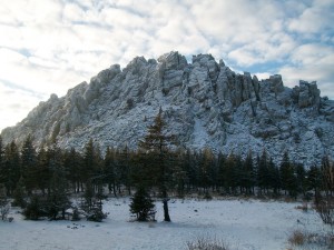
“Taganay” is a small mountain country with peaks, rapid rivers, mountain ranges, rock streams, alpine tundra and a small boreal forest. It is these places, the Ural Tirol, is used to be shown to guests from other countries, after all, there is a saying that he that has never been to Taganay, has never seen the Urals. The length of Taganay range is 25 km. It stretches along meridian and includes peaks which are higher than 1000 m: there are Dalniy Taganay (Long-range Taganay – 1148 m), Kruglitsa (1177 m), Otkliknoy Greben (Otkliknoy Ridge – 1155 m), Dvuglavaya Sopka (Double-headed Hill – 1041 m) with extremely different peaks – Perya (Feathers) and Baranyi Lbi (Sheep’s Forehead), Middle Taganay, Small Taganay, Monblan, Itsil, Yurma.
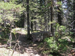
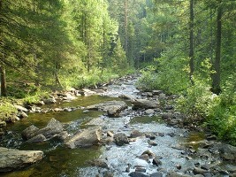
There is a crossing — Valley of Fairy-tales (1000 m) — between Otkliknoy Ridge and Kruglitsa; it is a unique place of a low dark coniferous forest, where there are “Jags” and “Sculptures” of fancy lost rock mountains appeared in places. Big Rock stream derives from the boulder flamboyant quartz of different colors at the southern bottom of the valley (the length is more than 5 kg, the average width is 100-200 m). Here are mostly dark coniferous forests – Siberian spruces and firs. But you can see both birches and lime-trees, and in the south-eastern park you can see maple and mountain elms. The headwaters of Big Kialim breed river trout. The watershed boundary passes between two river basins of Russia in the grounds of park – Volzhsko-Kamskiy and Ob-Irtishskiy ones. Ground waters are exposed as scores of springs. White Source is the most famous one which is situated on the eastern slope of Double-headed Hill. The water is as good as snow slush by its geniality, and there are knockings of bastard quartz in the bottom.